A trail that can be run in two directions for different experiences. Perfect for all skill levels as it gets harder as you get faster. Great trail for training or endurance looping.
Directions to Pemberton Trail
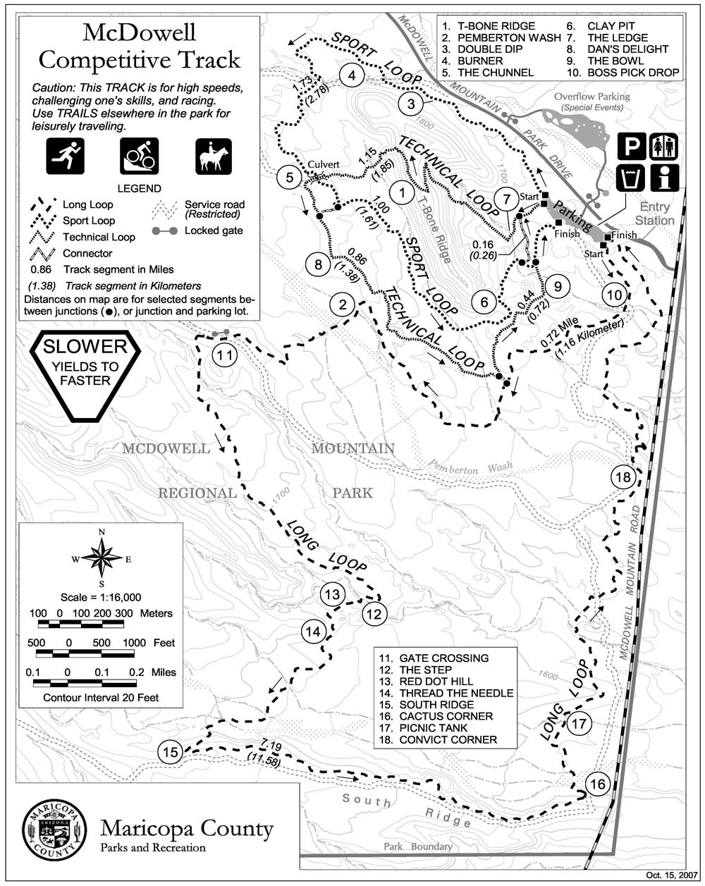
Located in McDowell Mountain Park Metro Phoenix area. From HWY 101 North Loop and Pima Road drive north to Dynamite Road and go east to end of road. Take right “tee” onto Rio Verde Rd. and go south to stop sign and turn right continuing on Rio Verde. Follow to park entrance on right and enter park ($6 user fee per vehicle). Drive to Pemberton loop turnoff and park near restrooms at bottom (map at entrance gate outlines route to trail head).
Pemberton Trail Specs
Classification: Cross Country
Trail Difficulty: Whoa! Air Time! (medium)
Trail Traffic: Little Help Here (medium)
Pemberton Mountain Bike Trail Review
The trail itself is composed mostly of decomposed granite and rocks. The grip is pretty good with a low rolling resistance tire, but watch tire pressure! It is tempting to run higher pressure to gain speed, but the higher pressure will lessen your footprint and make the going slick. There are no drops of greater than six inches and most climbs are short steep ones with lots of room to recover. Riding the trail clockwise will start you on a slight up grade (1-3%) for the first five miles. There are a few little rollers tossed in. Most of the climb up is single track with semi tight switchbacks. The higher you go the better the view gets in front of you as the McDowell Mountains get closer. The view behind is getting good too, but you will get plenty of that on the second half!
Around mile five (this is such a fun trail I rarely track mileage on it) you hit the plateau and the roller section which is twisty, water barred (air time!) and quick up and downs. This is where the technical aspect ramps up as you go faster. The short downhills with water bar jumps entice you into higher speeds for bigger glory with short braking areas into off camber slick 90 degree turns and hairpins which put you smack into a short quick uphill run. Ride faster and you must brake harder on the crushed granite which makes tires lock up and sends more than one rider off the trail on tucks the front wheel and slams you to the ground. Caution is your boring friend here and more often than not I find myself telling him I will meet him at the truck- Bye caution!
For the last 5-6 miles it is time to go back down to the trailhead on a mostly smooth, snaky two track. SS riders will be spinning and trying all kinds of new techniques to gain speed by tucking, standing, sitting, hands in- hand out etc. The gearies will drop the gear, drop the hammer and try to carry more speed through the turns- be careful- the traction runs out fast and talent runs out faster when you come across what looked like a nice 120 degree turn and find that the turn folds in on itself to avoid a large cactus pile that has sucked in many riders before you- it is still hungry- look out! The nice long down hill drops you to the trailhead lot where after a drink of water- your refreshed legs want another go at it. Why not run it the other direction?

Some trail traits:
-
- Beginners love this trail as it gently exposes them to distance (half is downhill) and they can come back and learn what faster feels like and and how it affects the ride.
- Experts like the endurance race feel to the trail (one is held here yearly) and it is perfect for training on. The trail lends itself well to conditioning and learning to control heart rate.
- There are nice flush toilets and showers on site at the trailhead.
- You cannot get lost here. If you get turned around- find a trail and go down. No matter where you are lost at you will hit a paved road within 8 miles.
- Nearby Fountain Hills has some nice small restaurants and bars for after eats!
Located in McDowell Mountain Park which also has competitive MTB right of way loops, and links into over 70 miles of trail from mild to way too wild! Maps located here.