Mountain Bike Trail Review
Cerro Gordo in Vega Alta, Puerto Rico
Review written by Lemuel Beauchamp
Cerro Gordo Mountain Bike Trail Infomation
Directions to the Trailhead
Cerro Gordo Beach
Road 690
Vega Alta, PR
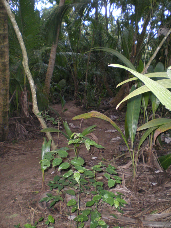
After you get to the Cerro Gordo Beach Facility and park your car, go to the east and climb a small road, then follow a path next to the fence until after about 500 yds. you will find an entrance to your left.
Trail Classification
All Mountain
Trail Difficulty
Whoa Air Time (Medium)
Trail Traffic
Little Help Here (Medium)
The Cerro Gordo Trail Review
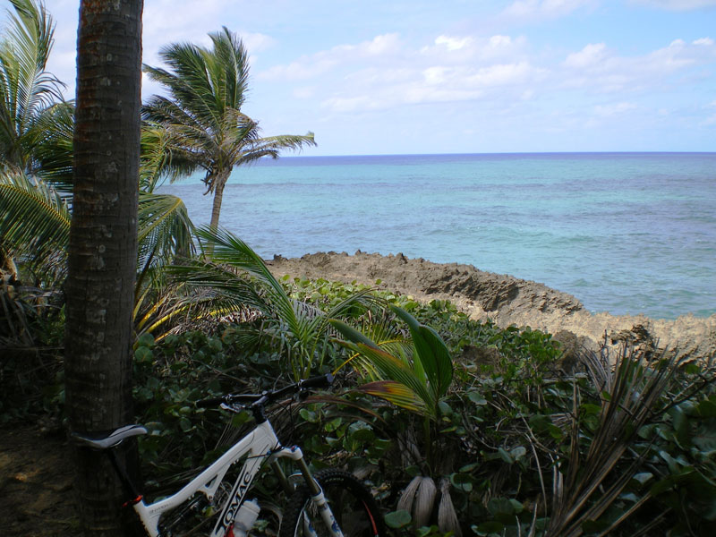
I remember the first time I rode my favorite trail. Every turn gave me the feeling of Christmas morning opening gifts. Every technical section was thoughtfully designed to challenge and entertain at the same time. “It has it all” I thought silently in my mind, while the wind from the beach traveled through the palm trees, as a prelude of what was soon to come.
The demanding climbs are rewarded by steep and molded descents, which in many occasions surprise you with spectacular views of the Atlantic Ocean. Ah’ nothing like the tropics to bring out the blue in the water.
Cerro Gordo Beach, in the town of Vega Alta, is located in the north central section of the island of Puerto Rico. It is home to many great beach spots, resorts and privately owned beach houses that will have you staring at their designs. There are many of these that are available for rent, making this area an ideal homebase for mountain biking the northern part of the island, while having many other amenities just minutes away.
By now you are saying to yourself, how did they mixed all these elements in one place? The answer is much bigger than that. You see, in my humble opinion, Mother Nature had a big role shaping this place. For starters, the location is ideal for this, and only this. There could not have been any other development in this stretch of land, and that is a gift to us.
One thing that you must keep in mind is that the descents are steep, and it is very important to pick your line preparing for sharp turns, usually to the left, at the bottom of each slope.
As you advance in this section, you will run into one of the iconic signs of this trail, a small square building with a NO BRAKES painted on the sidewall, an then, adjust your seat belt because you are in for the descent of your life which will be topped by one of the most spectacular views of the trail. At this point there are just a few more turns a small hills and you will soon be finishing the longest 3.5 miles of your life. It all be like a blur, but if you feel like it, and believe me you will, you can turn left and start all over again.
Most locals at least run the trail twice, and on low traffic days, we run it backwards. Luis Tiles, a good friend and the best bike mechanic I know, told me once, “If you can ride a trail backwards, it was a good design” In this case, riding the trail backwards has given me the opportunity to understand it better and ride it more efficiently every time around. It also gives you the understanding of why they put this here and that there, it is like picking the brain of the designer without his permission.
Thanks to it’s variety, conditions, scenery and design, this trail deserves to be my favorite, and it will be yours after you ride it.